Page 1
You need to input data in most visible fields. This is to ensure that you have not missed any data.
Once you have finished inputting data, you need to run the Quality Assessment checks by clicking on the 'QA record' button
You will not be able to perform calculations until your form has passed the quality assessment checks
Coordinate system
You can choose one of three coordinate systems to reference your site location (see below):
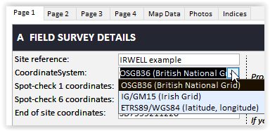
For UK and Irish grid reference systems, you need to provide a 10 figure grid reference e.g. SD8012611641 or O1469834233. Once you have entered the grid reference, it will be automatically converted into latitude and longitude under the WGS84 system (decimal degrees) and in eastings and northings for the mid site grid reference. The conversions will be displayed on the Map Data tab (see below).
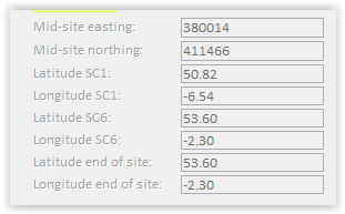
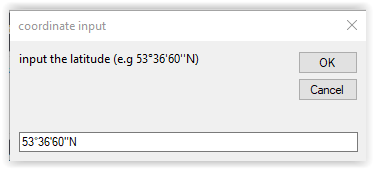
If you choose to enter your data using the WGS84, you need to input the data in decimal degrees (e.g. latitude 50.81 and Longitude -6.54). You can also input the data in degrees/minutes/seconds by double clicking the relevant field (e.g. Latitude 1) and clicking OK. The software will automatically convert the data to decimal degrees.
You can also use the 'Coordinate System' dropdown box to convert WGS84 data to Irish or UK grid reference systems: see link
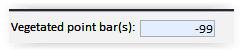
Number fields
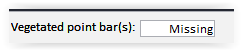
If data have not been recorded by surveyors for number fields such as in section C or D, you need to enter the negative number -99 and the software will automatically display the data as missing.
Automatic input of data
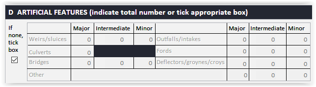
If no artificial features have been recorded in section D, tick the check box on the left and all fields will be set to '0' and become inactive (greyed-out) to avoid any data corruption.
Data Input Tips