Learning about the river history:
the reach info tab
Most knowledge is in people's minds and memories. The Environment Agency for example, hosts on its servers vast amounts of data on water quality, biological quality and river habitats but there is no repository for local knowledge accumulated by generations of staff on the river history and associated events and anecdotes. As part of the research carried out for the project, local staff identified that a module for capturing and storing local knowledge on river reaches would bring tremendous added value to the Decision Support System.
Using the reach info tab, information about historical events can be captured, dated and geographically located. The general history of the river can also be recorded.
Reach History
In the left-hand panel, there are seven categories of events that can be recorded or viewed. If you click on any category title, a list of associated events will appear in the left and right panels. To view an event, simply double-click on the corresponding line in the list.
Tip: instructions as to what to do will appear if you hover with the mouse specific parts of the screen
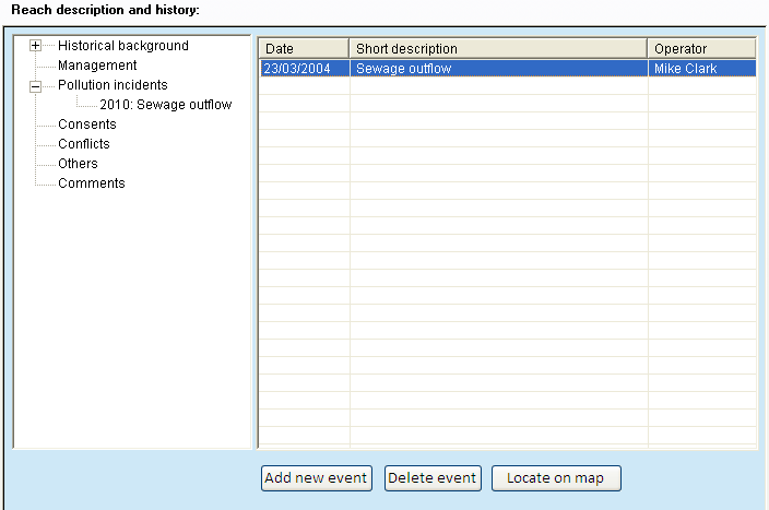
Double-click on the 'Sewage Outflow' to view the event.
Detailed information about the event is now visible. To learn more about the person who reported these particular pollution incidents, double click on his name.
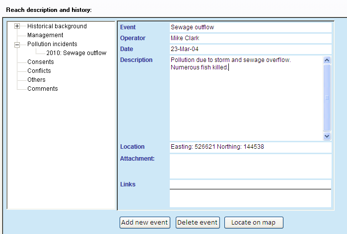
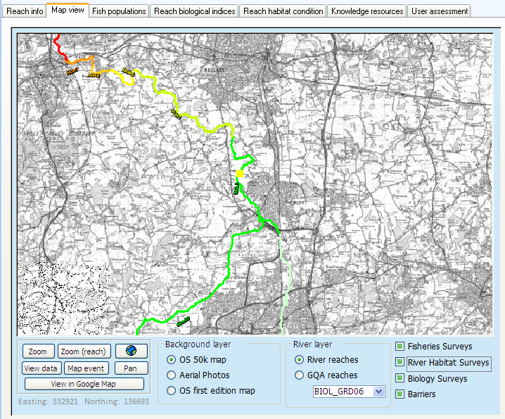
When event coordinates are indicated, you can click on the ' locate on map' button and it will take you to the 'Map view' tab and locate the event using a yellow circle.