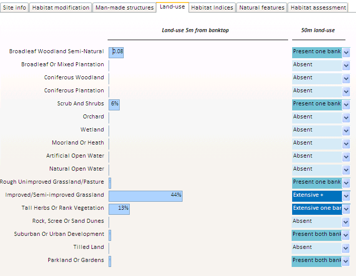
Land-use
At each RHS site, land-use extent is assessed within 5m and 50m of the banktop on both sides. The bar chart below shows the average extent of 17 RHS land-use types along the river bank in percentage term for the immediate land-use and using a semi-quantitative scale (Absent, Present and Extensive) for the wider land-use. Greyed-out land-uses were not recorded. Land-uses marked as 'Extensive +' were extensive on one side and present on the other side.
The dominant land-use at our reach is improved grassland both immediately at the banktop level and beyond.