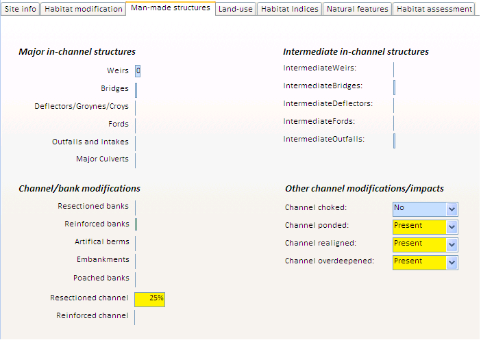
Man-made structures
The third tab contains more detailed information on made-made engineering structures.
The average number of in-channel structures, and the extent of bank and channels modifications are shown using colour-coded bar charts (green: extent less than 20%; yellow: between 20% and 30%; orange: between 30% and 60%; red: extent greater than 60%).
The terms 'major' and 'intermediate' used to qualify in-channel structures refer to the RHS and reflect the size and impact of the structures on channel hydrology and morphology (see RHS Manual).
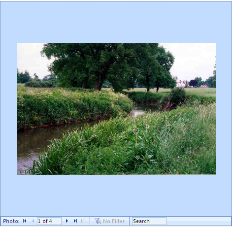
It seems that the major modification found on the reach is channel resectioning (i.e. overdeepening). Little bank resectioning was observed on the reach. This is surprising as bank and channel resectioning are generally associated. Indeed, when resectioning a river, engineers use diggers to overdeepen the channel and reprofile the banks to create a typical trapezoidal channel. If we look at the photographs of one of the sites, site 1274 for which no bank resectioning was observed (see below), we notice that the banks have a fairly uniform 45 degree bankface and trees are lacking or tend to be scattered on the river bank. This suggests that the extent of bank resectioning on site may have been underestimated by the surveyor.
It is important to note that the data and models are not fault proof and some of the features may have been missed out or under recorded by surveyors during surveys. Fortunately, ToolHab provides a whole range of data with adjoining maps, site photographs and aerial photos that enable experienced users to quality control model outputs and produce their own diagnostic based on expertise and the data and models available. In this case, an important sign of modification has been missed out by one of the surveyors but we were able to stop this error and we will be able to take that into account when analysing predictive models outputs and doing our final assessment.