Viewing survey data:
The barriers data form
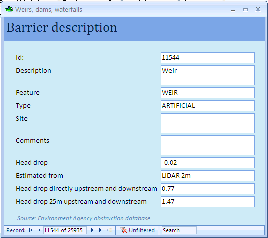
The barrier description form provides detail on the nature of the structure and its potential impact on river connectivity. The difference in altitude before and after the layer have been estimated to be around 77 cm just upstream and downstream of the barrier and 1.47 m when measuring altitude 25 m upstream and downstream of the barrier.
The information is taken from the obstructions database compiled by the Environment Agency. The dataset has limitations and some of the structures listed may not longer exist.
First, use the  button to zoom to the sites of interest. Then select one or more of barrier sites using the
  tool. The following form will open (see below). The number of sites selected and displayed is indicated at the bottom left of the form. You can view site data using the navigation buttons at the bottom of the form.