Section M: Features of Special Interest
SECTION M: FEATURES OF SPECIAL INTEREST
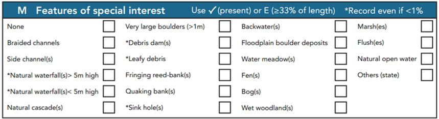
This is an opportunity to record features of special ecological interest, either in the river channel or adjacent corridor.
The extent of all these features should be recorded as present (✓) if present along >=1-33% of the site, or ‘E’ if present along >=33% of the site. Five of the 21 listed features are marked by an asterisk (*) – these can be ticked even if they do not occur within at least 1% of the site.
Special features should be recorded as ‘✓’ or ‘E’ if they are within a 50m corridor either side of the channel. Where features of special interest are observed beyond this 50m limit, their presence should be noted in Section O.
None
An entry is required in this box when no entries are made in any other boxes to confirm that no features of interest were observed.
Braided channels
Braided rivers are dynamic, mobile, rivers where the channel is divided into several sub-channels separated by active mid-channel bars along most (>50%) of the 500m site. In braided rivers, most bars are unvegetated and the wetted area, at low flows, represents substantially less than 50% of the river bed. Bar surfaces are typically at lower elevations than the vegetated floodplain margins. Braided rivers must feature at least two sub-channels and two mid-channel bars along most of the site. Some of the sub-channels may be dry at the time of the survey.
Excludes all river reaches with more than a single channel that are not actively changing the location of the sub-channels – these include:
- where two or more channels have developed naturally and are separated by vegetated mid- channel bars or mature islands;
- man-made by-pass channels, including mill leats;
- secondary feeder channels;
- parallel floodplain drainage systems;
- chalk streams with multiple, man-made, channels.
It is recommended that aerial photographs are included to confirm braided rivers.
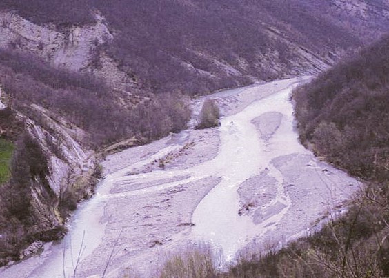
Example of a braided river
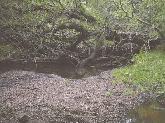
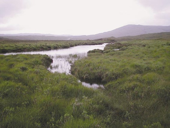
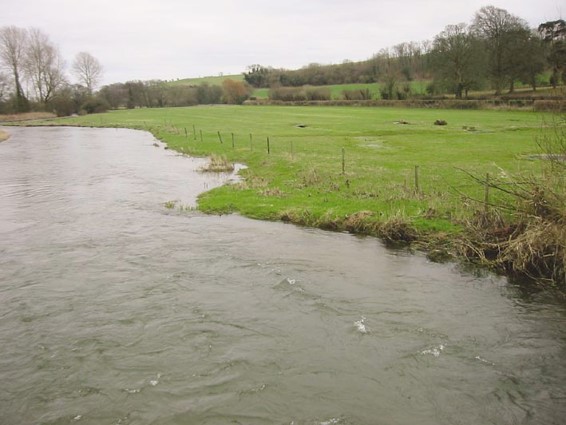
Side channel(s)
To be considered as features of special interest, side channels must be natural, and convey only a minor flow compared with the main channel. They may be dry in periods of low-flow, and will always have bed levels higher than in the main channel (cf. multiple channels associated with islands). Side channels generally indicate channel migration across the floodplain, and are most often associated with down-cutting of the main channel. They are always connected to the main channel at their upstream and downstream limits (which may be outside/beyond the site), and convey flow during moderate to high flows (see figure below).
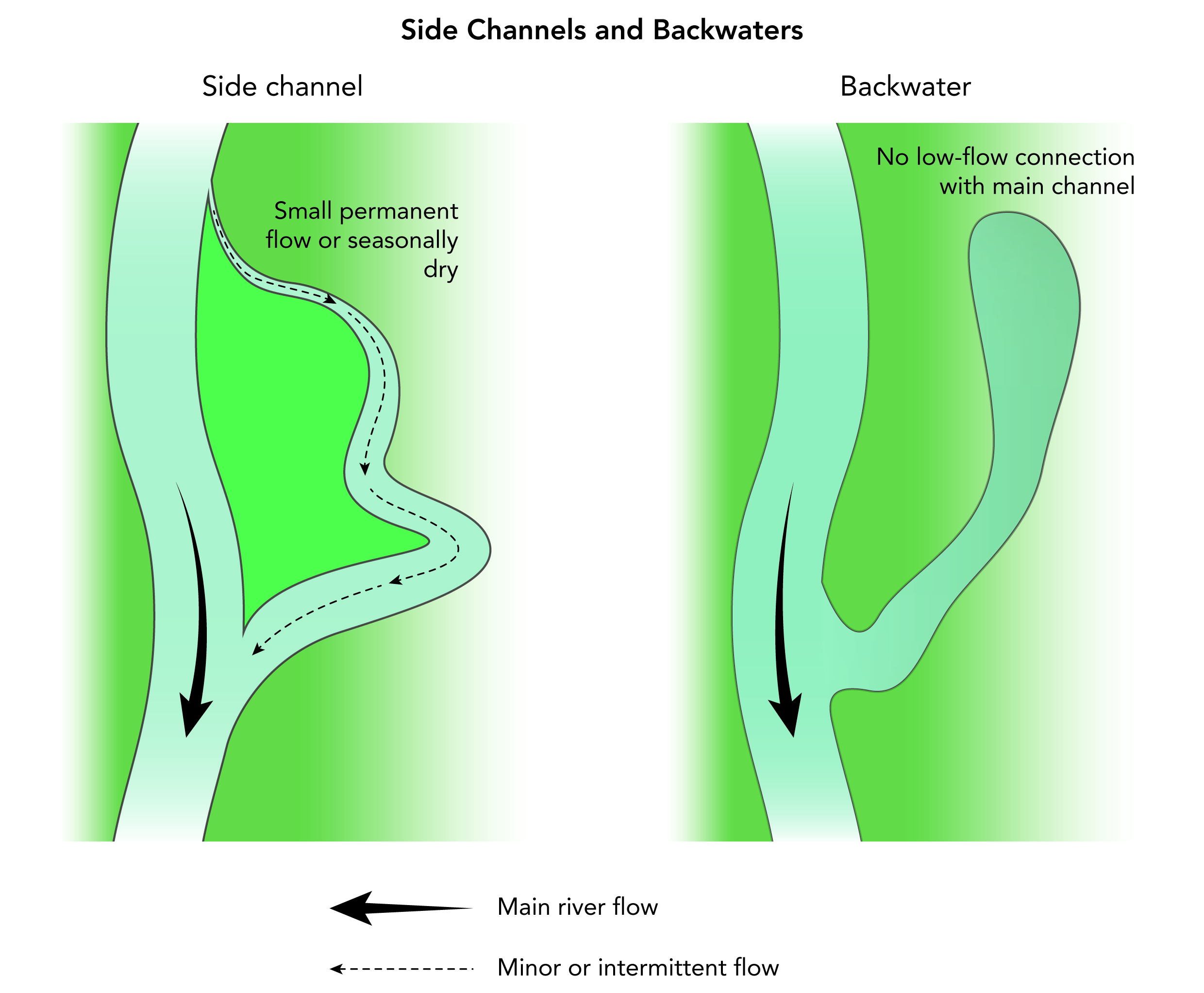
Side channels and backwaters
Do not record as special interest features any artificial channels (e.g. mill races, water meadow feeder channels and multi-channels of chalk rivers) which can be recorded in Section O as appropriate.
*Natural waterfall(s) >5m high
Uninterrupted natural free-fall flow more than 5m high.
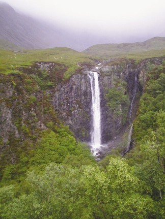
Example of a natural waterfall >5m high
*Natural waterfall(s) <5m high
Uninterrupted natural free-fall flow < 5m high.
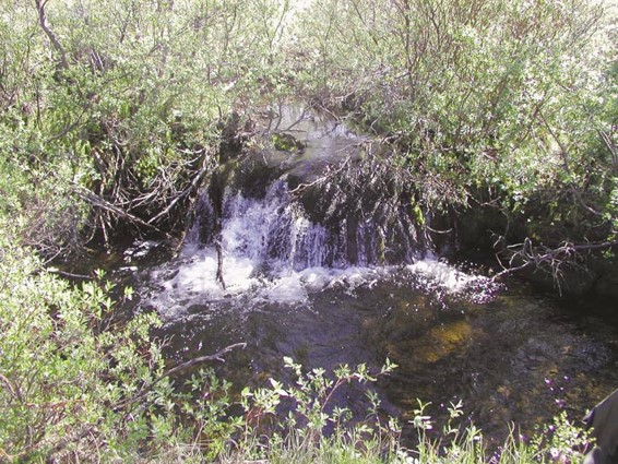
Example of a natural waterfall <5m high
Natural cascade(s)
Distinct series of ‘stepped’ flow features occurring over boulder substrate or bedrock outcrops.
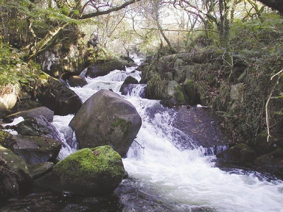
Example of a natural cascade
Very large boulders (>1m)
Very large, (at least 1m diameter), boulders protruding well above water level. Very large boulders will be recorded as extensive only if they occur along more than 33% of the channel length. Only naturally occurring boulders are noted; those introduced for fisheries enhancement purposes, or derived from collapsed rip-rap, are excluded but can be recorded in Section O.
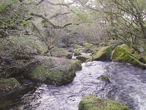
Example of very large boulders
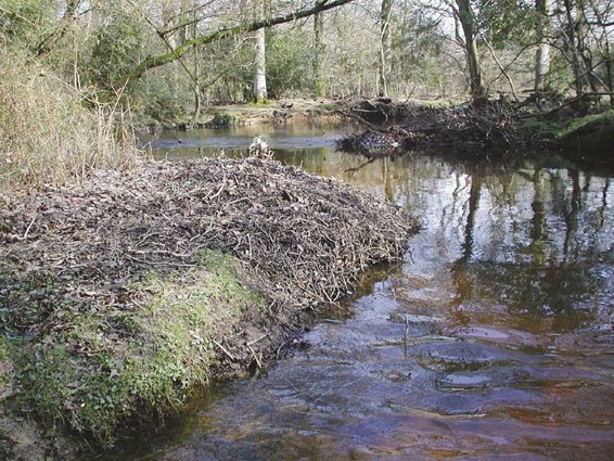
*Debris dam(s)
Log jam of large woody debris creating an obstruction across the channel and significantly impeding water flow.
Example of debris dams
*Leafy debris
Significant accumulations (at least 2m2) of twigs and leaf litter along channel edge. An important temporary habitat for some insects.
Example of leafy debris
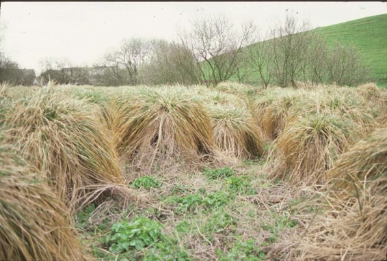
Fringing reed-bank(s)
Fringing reeds such as common/Norfolk reed (Phragmites australis) which extend at least half-way up the bank. To be recorded, a fringing reed-bank must extend at least 10m along the bank-length.
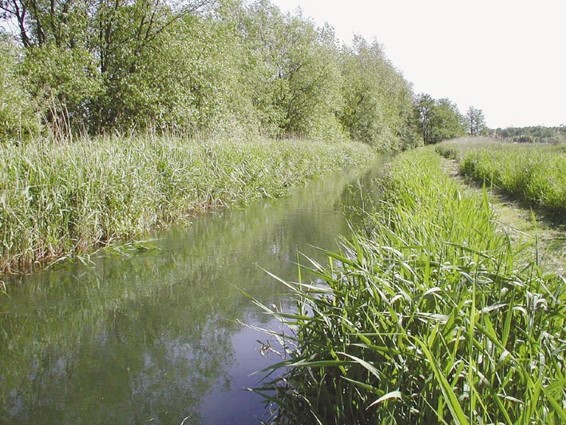
Example of fringing reed banks
Quaking bank(s)
Adistinct floating ‘ledge’ or shelf of vegetation only, equivalent to a ‘quaking’, bog which extends into the channel. Usually an extension of adjacent wetland into the channel. Very rare in Britain and Ireland.
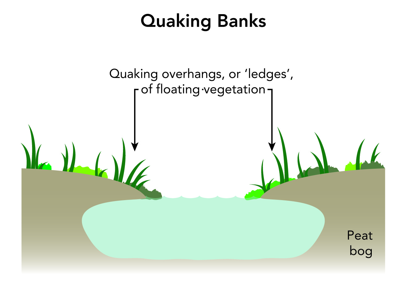
Graphic illustrating quaking banks
*Sink hole(s)
A feature of some channels in limestone areas. Except during spates, flow in the channel upstream disappears into the ground through the channel bed, re-appearing further downstream.
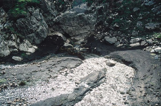
Example of a sink hole
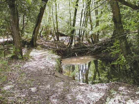
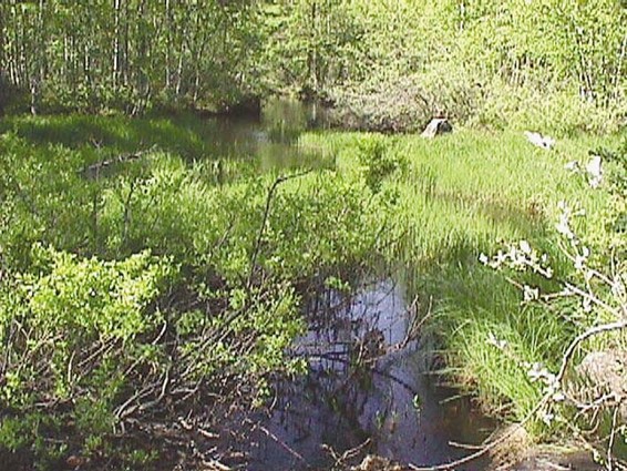
Backwater(s)
Redundant river channels that are connected to the main channel only at one point, normally the downstream end. In contrast to side channels, they do not act as flood-conveyance channels (see Figure M1).
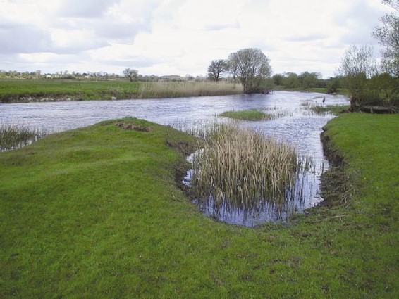
Examples of back waters
Floodplain boulder deposits
Boulders deposited on the floodplain by the river, typically close to the banktop and downstream of a constricted section of channel (e.g. gorge or V-shaped valley). Boulders in the channel should be recorded as boulder substrates or exposed boulders, as appropriate, and not floodplain boulder deposits.
Example of flood plain boulder deposits
Water meadow(s)
Floodplain meadows, primarily associated with chalk streams, and traditionally flooded via constructed feeder channels. These drainage channels are straight, shallow and parallel. Features include remnant channels and floodplain grasslands.
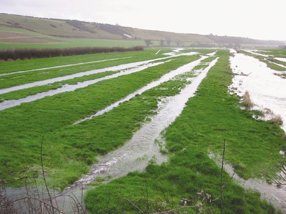
Examples of water meadows
Fen(s)
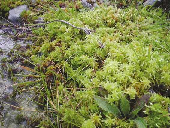
Wetland vegetation, often (but not exclusively) growing over peat, where the water-table is at, or just below, the surface. Water is derived from both rainfall and drainage of surrounding land. Some fens may have Sphagnum moss, but typically the vegetation is dominated by tall reeds, wetland herbs, sedges, and rushes.
Example of fen
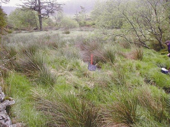
Bog(s)
Vegetation growing on wet peat where the water table is at, or just below, the surface. The water source is direct rainfall and in some cases, over-land flow occurs during heavy rain events. Sphagnum moss is always present, often with bog cotton (Eriophorum). In locally drier areas heather (Calluna, Erica) may also be present, but never dominant. When the heathland component is uncommon, and bog predominates, record ‘Moorland/heath’ as ‘present’, and record ‘Bog’ as ‘extensive’.
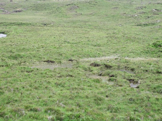
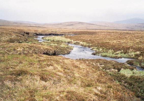
Examples of bogs
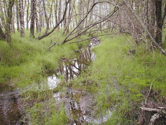
Wet woodland(s)
Wet woodland comprises trees such as willow (Salix spp.) and alder (Alnus spp.), usually with an understorey of wetland herbs, reeds and mosses. Often at the edge of other wetlands, and often referred to as ‘carr’.
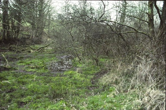
Example of wet woodland
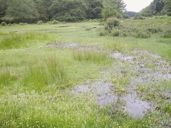
Marsh(es)
Wetland habitat that includes tall grasses and rushes on periodically wet ground (unlike fen or bog that are permanently wet), or where wetland herbs are an important component of the ground flora (e.g. meadowsweet – Filipendula ulmaria, marsh orchids – Dactylorhiza spp., kingcup – Caltha palustris, valerians – Valeriana spp.).
Example of a marsh
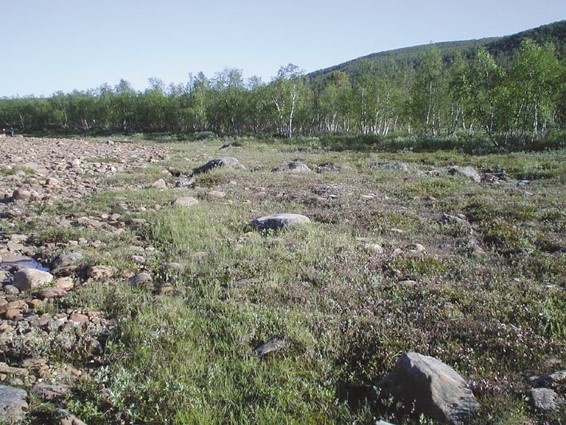
Flush(es)
A collective term for wet areas near springs where water emerges from the ground or seeps from fissures in rock faces, or valley slopes. Flushes are fed by groundwater – when surface water predominates a stream is formed.
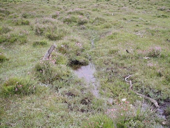
Example of a flush
Natural open water
Includes abandoned ox-bows, natural lakes, bog-pools and meres. Only include features that are NOT connected to the river channel except during periods of floods.
Examples of natural open water
Others
It is important to record any other features of ecological interest, such as reedbeds, herb-rich wet grassland etc. associated with the river and adjacent land.