cRHS Form Page 2
cRHS Form Page Two: Sections G, H & I – Spot-checks
It is essential to indicate on the form whether spot-check one (1) is at the upstream or downstream end of the site; tick one box only.
Ten spot-checks must be completed at regular intervals (c50m) along the 500m site (see animation below).
At each spot-check, stand on the bank and look across the channel and indicate in each box, in each column, the material, modifications and features present. In shallow rivers, and where safe to do so, surveyors may choose to enter the channel to improve accuracy of recording bed character and features of the opposite bank. Risk assessment is vital before entering the channel.
All boxes in sections G and H must be completed (i.e. entries made in ALL boxes in the column representing an individual spot-check) before moving on to the next spot-check. At least one box in Section I must also have an entry for each spot-check. Each entry must be made clearly using the unique abbreviations shown in the spot-check key and described below.
Bank
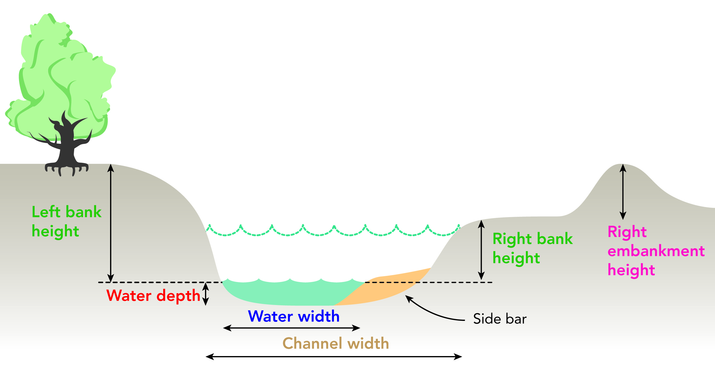
Permanent side to the river channel. For recording purposes (see figure below) the bank starts at the water’s edge (and excludes marginal depositional features such as bars) and gives way to the ‘banktop’ where the break of slope allows cultivation or development to take place.
Left and Right banks
‘Left’ and ‘right’ banks are determined by facing downstream.
Cross-section of channel showing definitions used to define where spot-check recording and channel dimensions measured
For physical attributes (G), use a transect 1m wide at each spot-check across the channel. For land-use, vegetation structure and channel vegetation types (Sections H and I on page 2), use a 10m wide transect, at the same location.
Only one entry per box is allowed for recording predominant bank material.
More than one channel or bank feature or modification can be recorded at a spot-check. In these cases, use a diagonal line to include a further entry in the box.
Only one entry per box is allowed for recording both predominant channel substrate. Only one entry per box is allowed for recording land-use and bank and banktop vegetation structure. For channel vegetation, occurrences of all types are entered into appropriate boxes.
GPS readings are required at spot-check 1, 6 and at the end of site, 50m beyond spot-check 10.