River reach Decision Support tool
The river reach Decision Support tool was designed to help with the assessment of habitat quality for 23 species of fish, the identification of pressures and impacts and the design of restoration/habitat improvement measures.
River reaches were defined using 4 indices representing habitat dimensions (i.e. substrate type, flow type, channel vegetation structure and activity) that were mapped along the river network using predictive models and GIS data. Each reach represents a homogeneous morphological unit with regards to the four dimensions mentioned above as observed now and at reference condition. Each reach should therefore contain only one habitat type (for example a reach dominated by riffles and runs over cobbles/gravel-pebbles substrate mix with no marginal vegetation and high levels of erosion and deposition) that is different in one or more of its components from river reaches upstream and downstream. It is important to note that river reaches will be homogeneous in terms of the observed habitat on the day of survey and habitats as they would be if the reach was unimpacted by human activity. To learn more about the technique used to derive river reaches, go to appendix 3
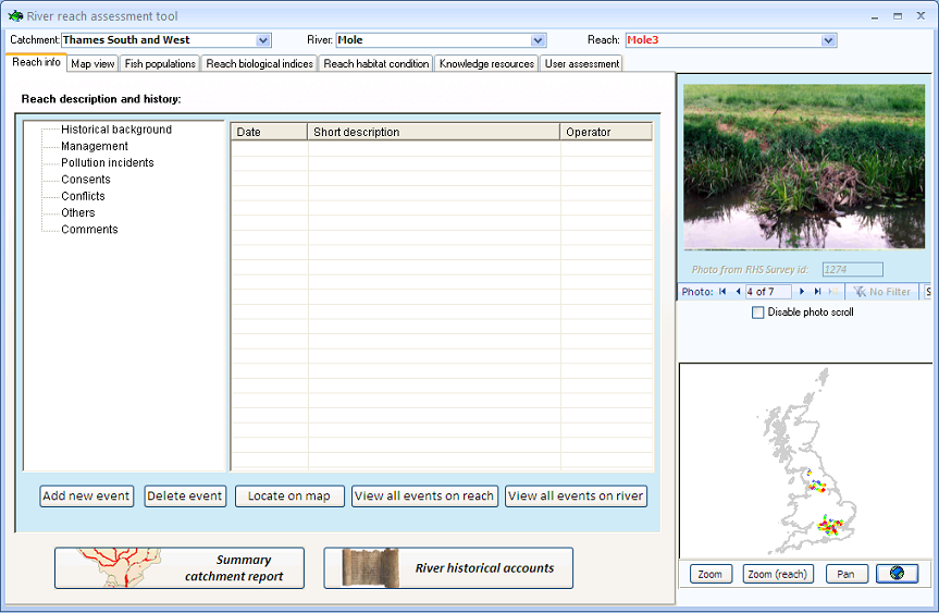
Using this technique, the river reaches for 15 rivers selected to be part of the Decision Support System were defined and given a unique name and identification number based on their position in the catchment. Existing fisheries, biological, RHS and barriers data points were then associated with their respective river reaches using GIS and summary statistics were produced. The river reach decision support tool displays summary data for all river reaches (the view below shows the data associated with the default river reach on the river Mole).
The reach assessment tool contains seven tabs.
At the top of the window are three drop-down boxes with information about the selected reach.
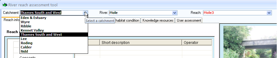
To select a river reach, start by selecting the relevant catchment using the 'Catchment' drop-down box.
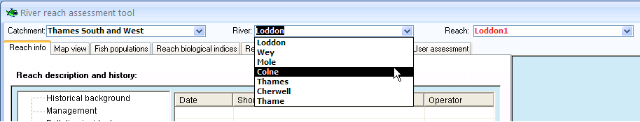
Then, use the 'River' drop-down box to select your river of choice.
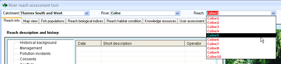
Then use the 'Reach' drop-down box to select a reach. For each river, river reaches have been numbered in ascending order from source to mouth. River reach ids containing a '0' ( e.g. Mole03) generally are on tributaries or on adjacent arms of the river.
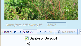
Photographs of River Habitat Survey (RHS) sites associated with the selected river reach are displayed on the right-hand side in a slide show. To stop the slide show and view the photos individually, check the 'Disable photo scroll' box and then click on the navigation buttons  to flick through the photographs.
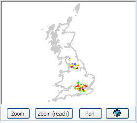
In the bottom right-hand corner, is a small map displaying all 15 rivers. You can zoom in and out of the map using the zoom button (left click to zoom in and right click to zoom out). You can also click on the 'zoom (reach)' button to display the selected reach.
Before we start the assessment of the reach, we will first look at the end of the process which is the 'User assessment' form.