Habitat indices
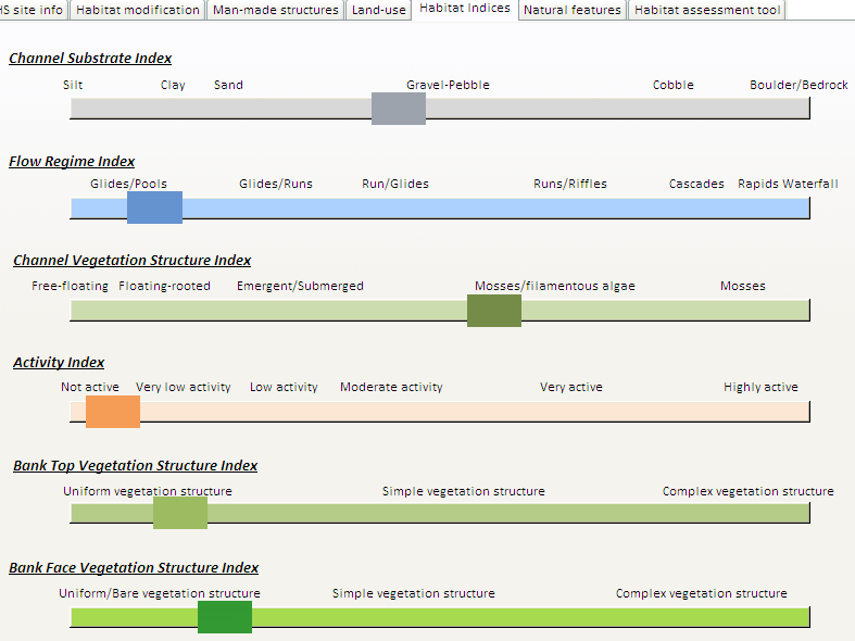
Information on natural habitat features such as channel substrate, flow regime (e.g. riffles, glides and pools), channel vegetation structure, activity (i.e. erosion and deposition features) and bank vegetation structure (from bare to complex) have been summarised into 6 indices presented on sliding scales representing the main environmental gradients encountered in natural settings (see River reach definition).
Each scale is labelled according to the feature(s) dominating at key points along its gradient. For example, the Channel Substrate Index represents a gradient between sites dominated by fine substrate on the left of the scale (silt, clay and sand) to sites dominated by coarser substrates (cobbles and boulders). This gradient represents the typical transition between headwater - upland and lowland streams. Similarly, the Flow Regime Index represents a gradient between sites dominated by slow-flowing features (glides and pool) towards sites dominated by faster-flowing habitats such as riffles and rapids.
The 6 scales enable a quick visual assessment of RHS site natural habitat features. For each scale, a marker indicates the location of the RHS site on the scale. In our case we can quickly assess that our site is dominated by gravel substrate but has slow-flowing features, little vegetation in-channel and poor bank vegetation structure. The site displays low levels of activity (erosion or deposition).
Combined with previous data on habitat modification and land use, these indices give us some insights into the potential impacts of the engineering structures and land management in general on river habitats.
