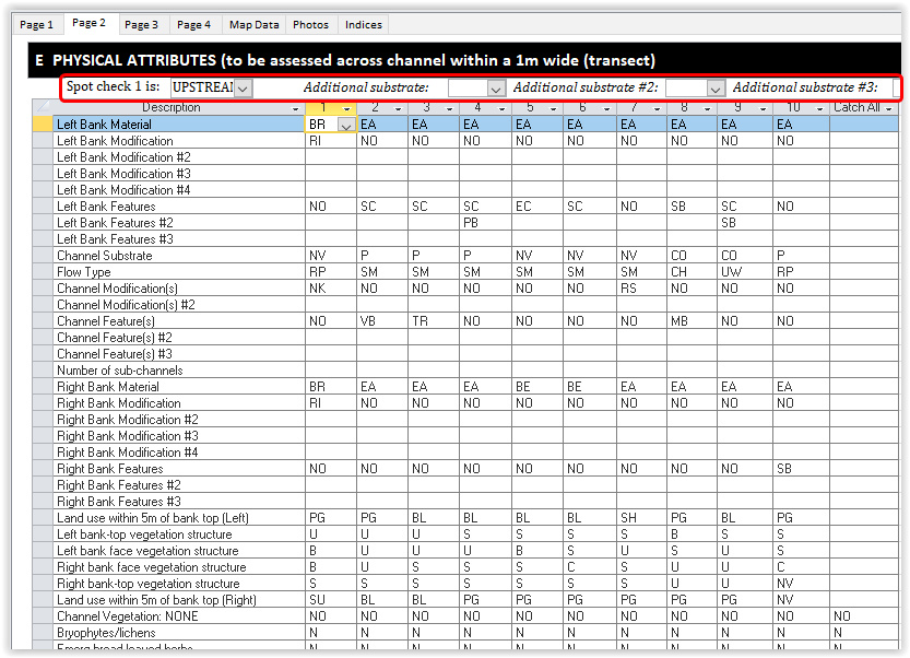
Page 2
Page 2 contains spot-check data. Each line corresponds to an attribute on the second page of the RHS form. Some of the lines are repeated and numbered using the hash sign (i.e #2, #3, #4). These lines correspond to attributes where surveyors can record more than one answer such as bank modification.
You need to input data in all lines except optional lines finishing in '#2', '#3' fields, e.g. 'Left Bank Modifications #2'). This is to ensure that you have not missed any data.
At the top of the page (see red square on the figure below), you can enter information on the location of the first spot-checks and the presence of up to three additional channel substrate types not recorded in the spot-checks and covering more than 1% of the channel bed.
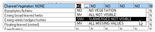
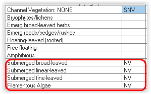
The 'Channel Vegetation: NONE' box will automatically fill spot-check information based on your choice. If you choose 'All Not Visible', it will put 'NV' in all lines for that spot-check. If only submerged vegetation was not visible, you can choose the 'Submerged not visible' option (see below).
Data Input Tips