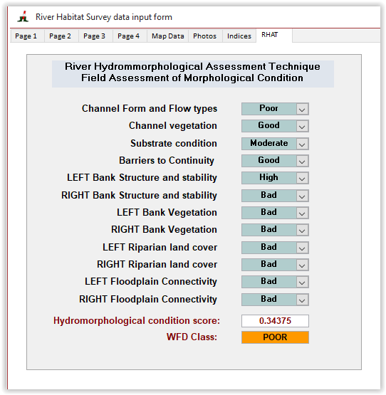
River Hydromorphology Assessment Technique (RHAT) scoring form
The River Hydromorphology Assessment Technique (RHAT) was developed in Northern Ireland by the Department of Environment to assess the hydromorphological condition of rivers for the Water Framework Directive (WFD). The field survey methodology was based on RHS and contains the same amount of information as a standard survey. The main differences are the width of spot-checks, which in RHAT are 50 m wide. The RHAT survey methodology also allows for partial surveys of the stream as the final scoring system does not rely on recorded data for its implementation.
The field assessment of morphological condition as part of RHAT is carried out in the field using expert opinion. Eight attributes representing bank and channel features and geomorphological functions are assessed on the scale of 0 (bad) to 4 (high) for their condition. Guidance on assessing condition is provided in the RHAT manual.
As the RHAT condition assessment is not calculated directly from survey data, it is possible to derive the score for a standard RHS. The RHAT condition assessment sheet was therefore added to the RHS toolbox as an additional option whilst doing surveys
The RHAT scoring form was derived from the RHAT manual available here