Coordinate choice and displaying data on online maps
You can view data on maps provided that you entered grid coordinates for the mid-site spot-check.
To do so, choose a coordinate system using the dropdown box on Page 1. At present, there is a choice of 3 coordinate systems including WGS84 (GPS and Google maps). The software will convert automatically grid references into WGS84 latitudes and longitudes (see mapdata tab).
Latitude and longitude must be entered in decimal degrees. To enter them as degree:minutes:second, double-click on the field.
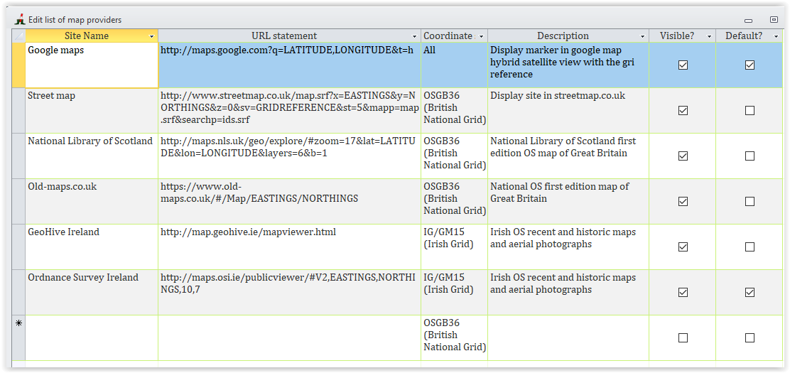
The dropdown box above the 'Show on map' button offers you a choice of online providers for displaying your site. The list provided is a function of the coordinate system and geographical location. You can edit the list and add online providers. To do so, click on the edit icon that will appear at the bottom of the list and a form will open. Then:
Please let us know if you wish to have coordinate systems added to the software.