Section H: Banktop Land Use & Vegetation Structure
SECTION H: BANKTOP LAND USE AND VEGETATION STRUCTURE
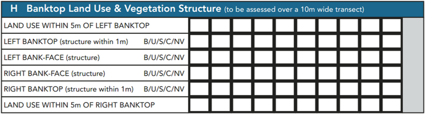
To be assessed over a 10m length of bank at each spot-check. Refer to spot-check key prompts on the form.
The contribution of adjacent land-use and vegetation structure alongside watercourses can contribute significantly to riparian habitat diversity.
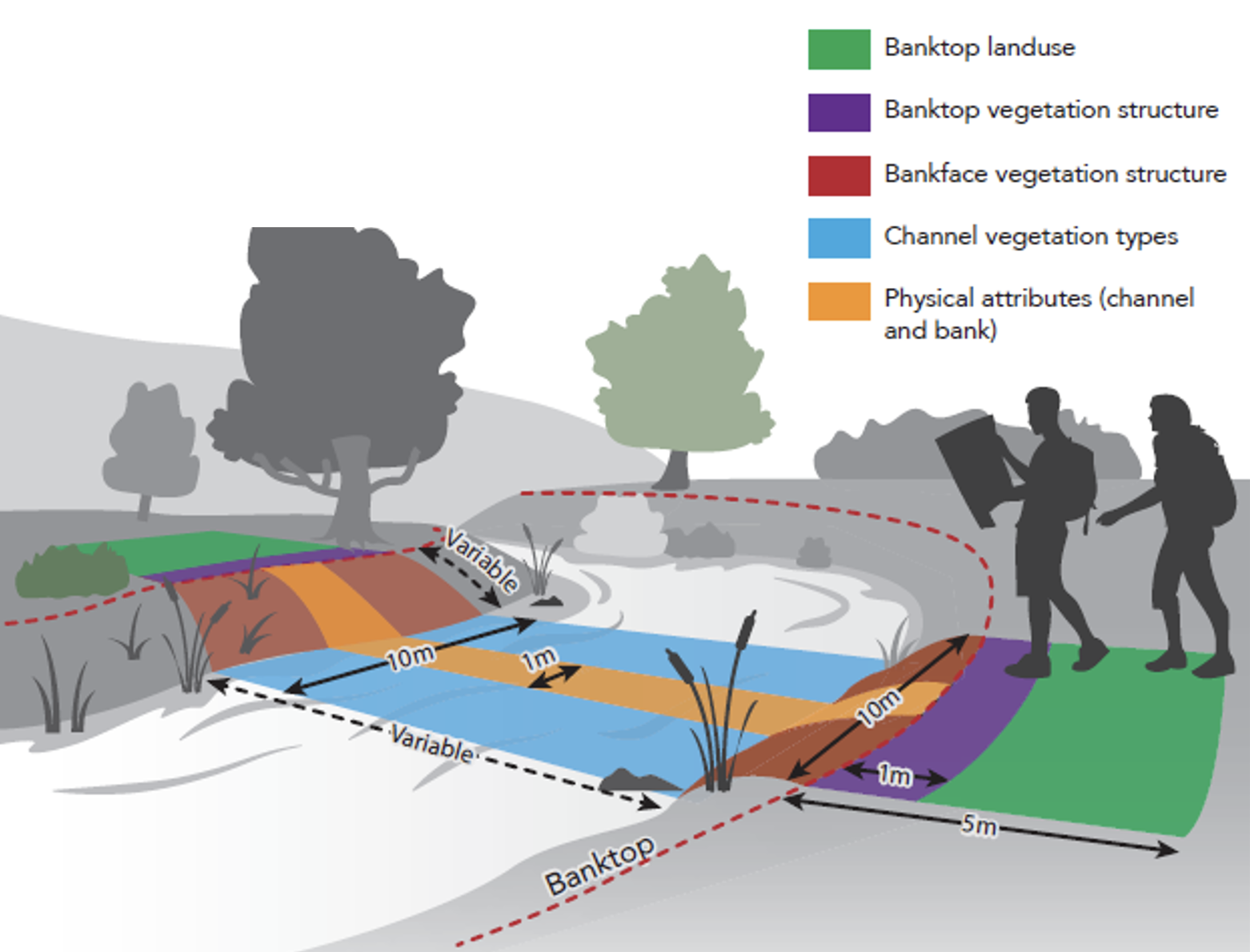
At each spot-check, using the 10m wide transect guidance (see graphic above), surveyors are required, for both banks, to record:
- land-use within 5m of the banktop, using abbreviations in the spot-check key;
- vegetation structure within 1m of the banktop;
- vegetation structure on the bankface, using ‘B’ (bare), ‘U’ (uniform), ‘S’ (simple) or ‘C’ (complex) categories. See sub-section below for guidance.
Since floodplain land-use up to 50m from each bank is also recorded in Section D, the combination of vegetation structure within 1m, land-use within 5m and a general overview of land-use will provide a collective picture of riparian habitat character.
Banktop
This is defined as the first major break in slope where cultivation or development would be possible. Where no distinct breaks in slope occur (e.g. streams in vee-shaped valleys), the bank height may be estimated by the winter flood level, often marked by a trashline or ‘notches’ at similar heights above the bed level. Notches may be seen along lines of exposed bank material that represent where vegetation has been ripped out by the roots at the level water reaches during times of peak floods.
Illustrated examples of banktop and bankface, as defined for recording vegetation structure and land-use during cRHS are shown in the figure above.
A banktop hedgeline should be recorded as complex structure (C) in spot-checks and not included as tree distribution (Section K). A hedgeline with scattered “standard trees” would be similarly recorded as complex structure in the spot-checks, but with “isolated” or “regularly spaced” trees (as appropriate) recorded in Section J.