Automated map data extraction for sites in England, Wales and Scotland (only available to licenced users)
To be able to run a context analysis with the RHS Toolbox, you need to derive altitude, slope, distance to source and height of source to calculate the PCA score for your site that will be used to select sites of similar types (see Jeffers, 1998 in References and Context analysis).
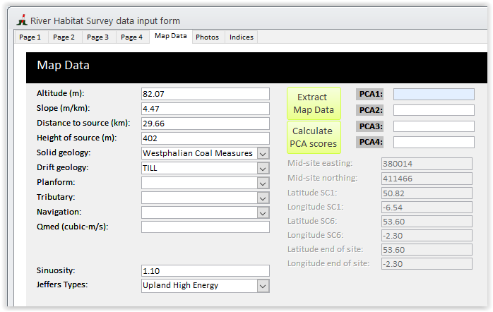
Using the RHS Toolbox, you can now automatically extract this information using a database of previously derived point on the river network. In the 'Map Data' tab, click on the  button and the following window will open after a few seconds.
The form will display all nearby points within 350m using the mid-site grid reference and you will be able to map them to decide which one to choose for your site (see below). Not all points will be suitable for selection. You need to select a point that is closest to your site and on the same stem of the river. In the example below, you assessment points 1 and 2 are located on the same stem as your site whereas assessment point 3 is located on a nearby tributary.
Simply click on the 'View all points on map' and your site mid-point will be displayed as a red place mark and all nearby assessment points will displayed as numbered placemarks corresponding to the numbers in the 'point' column on the main form.
This feature is only available to licenced users and is not available on trial versions.
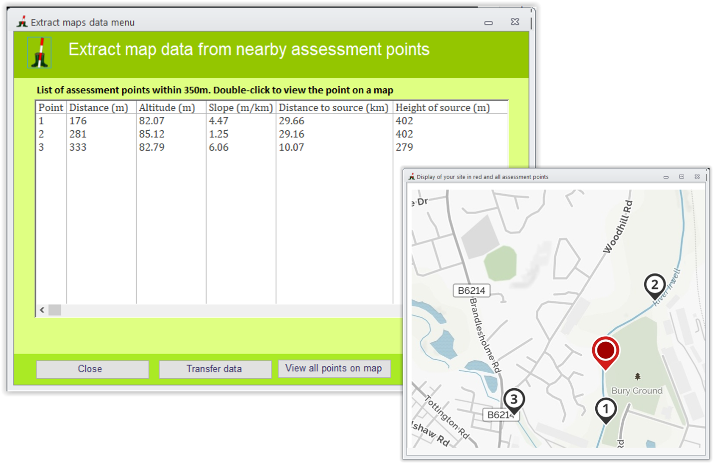
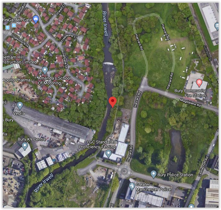
If you want to view each point individually on a map, double-click on the corresponding line and it will display the point in Google Map (see below)
Once you have decided on a point for extracting data, select it on the list and click 'Transfer data'
The process will not only extract data on for PCA score calculation (see Jeffers, 1998) but also background information on geology, sinuosity, typology using the Jeffers types (1998) and also predictions for four hydromorphological indices (Indices) in semi-natural conditions. This will enable the calculation of Hydromorphological Impact Ratio indices for your site to assess departure from semi-natural conditions.