Section B: Survey Information
SECTION B: SURVEY INFORMATION
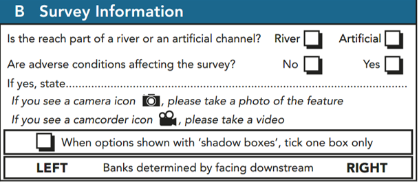
Is the site part of a river or an artificial channel?
Artificial channels are canals, dykes, ditches and drains constructed entirely by human activity. Natural rivers that have been extensively modified by human activity should be recorded as ‘rivers’ (e.g. navigation course of the Thames, concrete-lined urban streams). Tick one box only.
Are adverse conditions affecting survey?
Surveys should not be carried out in spate conditions. Take full account of the risk assessment carried out before embarking on a survey. Do not enter the channel if the water is turbid. Beware too that weather conditions can affect both safety and the accuracy of survey results - examples of conditions adversely affecting survey include: strong winds and heavy rain (affects flow-type assessment and recording on the field sheets); overgrown channels (where vegetation may hide some features). Tick one box only.
Photography (general)
A PHOTOGRAPHIC RECORD OF THE SITE IS ESSENTIAL TO AID INTERPRETATION OF DATA, AND AS A RECORD OF THE SITE FOR FUTURE REFERENCE. At least three general photos of the site must be taken, and any others for clarification purposes or as required by the survey (e.g. major and intermediate artificial structures). Sufficient photographs should be taken to illustrate the general character of the site. In more inaccessible sites it may be necessary to seek a vantage point that will provide the most comprehensive view. Avoid taking pictures across the river such as spot-checks as these provide very little information on overall site condition. Beware of lighting conditions and obscuring leaves and objects, especially when using a flash.
Examples of good and bad photographs are shown below.
Most mobile phones and some digital cameras offer the option to geotag photos and sometimes videos so that information of the photo's geographical coordinates are automatically attached to the photo. Please make sure that the geotagging option is switched on your device settings and that your GPS is on during the survey. Photographs provide extremely valuable information and are now easily produced and stored, so be trigger happy!
Finally, you can now purchase at reasonable price 360 cameras that take geotagged high-resolution photos that can be uploaded on maps and linked. Such photos are invaluable as they provide a picture of banks, channel, land use and wider landscape (example of a 360 river survey: https://tinyurl.com/ycduphhd). For the purpose of providing a virtual survey tour so as to enable quality control, further assessment and upgrade of your cRHS site to RHS compatible site, we encourage you to take 360 photo at every 5-10 meters along the site. Using the RHS Toolbox, you will be able to upload the photos on an online repository and create a virtual tour of your site. You can also upload your photos on Google map (StreetView) to make them widely accessible. To learn how to take a virtual tour, go to section 1, sweep-up.
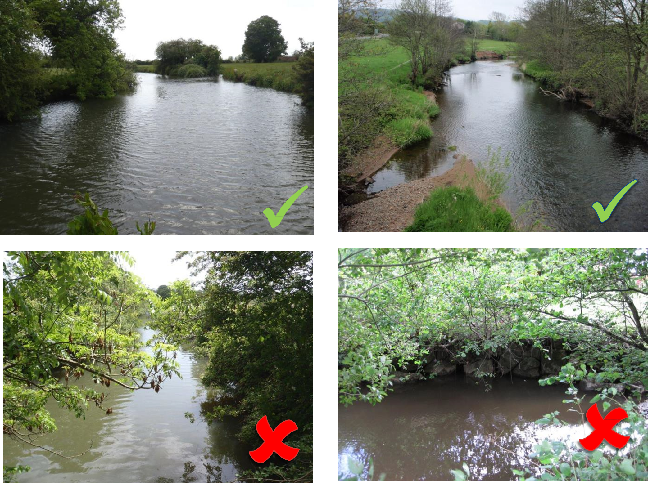
Example of good and poor photographs: the top two photographs provide a general view of the stream and its features. The top right photograph was probably taken from a bridge. The bottom two photographs provide very little information. The bottom left photo view is obscured by vegetation and the bottom right shot only displays a cross- section of the river.
Photographs of channel modifications and special features should also be taken. It is essential that all ‘major’ and ‘intermediate’ structures are photographed to enable interpretation of potential impacts to be made.
A good quality digital camera is recommended. If this is not possible, take colour transparencies with a film speed of ASA 200 or 400. The quality of digital photographs required will depend upon their intended use. For inclusion on the RHS Toolbox, a minimum 1024x768-pixel picture with a standard JPEG compression (100- 150kbyte) is required. For inclusion in printed documents, additional photographs at a higher resolution (e.g. 2048x1536 TIFF or JPEG) are recommended. A camera with built-in coding facilities is ideal as this should ensure photos are accurately assigned to a site, in the field.
If you are unsure about an unusual or unfamiliar feature, take a photograph for reference and make accompanying notes. Photographs that include, in the foreground, a chalk-board showing the site reference, will ensure photographs and site survey forms always correspond. It is the responsibility of the surveyor to check that the photographs and site reference match.
Videos (general)
A VIDEO OF EACH SPOT-CHECK MUST BE TAKEN TO ENABLE FURTHER ANALYSIS AND QUALITY CONTROL. Follow the protocol described in section 1, spot-checks.